Satellite Imagery
Using Satellite Imagery and Geo-Coded Survey Data to Improve Measurement Approaches and Targeting Programming for Family Planning
Short title: GIS-based population assessment
Role: Prime Recipient
Donor: The Bill & Melinda Gates Foundation
This project used GIS (satellite imagery treatment) and micro-census to produce updated estimates of the neighborhood population in Kinshasa and provide an updated sampling frame for FP services coverage analysis.
OBJECTIVES
- Replicate of the Vaccination Tracking System strategy implemented in Nigeria to provide updated population data for Kinshasa
- Building a searchable database of available FP services and develop an accessibility index that will integrate multiple dimensions of services availability (e.g. hours of operations, costs, presence of trained staff)
- Identify settlements, households, and individuals in DR Congo that may have been systematically missed in both surveys and programmatic activities.
- Provide local and international partners with updated evidence to support the definition of minimum FP services standards
The overarching goal of this project was to improve measures of FP services coverage in Kinshasa and refine the algorithms used by FP programs to identify and target underserved populations. Despite the existence of several large service delivery points (SDP) and population-based surveys, there have been very few analyses of FP services availability in relation to existing demand indicators, starting with the total population, as recent census data is almost non-existent for DRC.
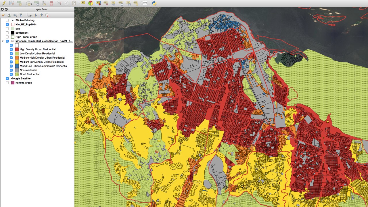
The research leveraged the unique capacity of Geographic Information System (GIS) to overlay information from multiple sources and analyze their relations, including distance variables, to conduct coverage analysis. Its main objective was to build a comprehensive geodatabase including both (1) most complete and updated information on FP services available in Kinshasa and, (2) updated population estimates using satellite imagery treatment. The latter was achieved by replicating the Vaccination Tracking System (VTS) strategy used by the BMGF Polio Team in Nigeria, which uses satellite imagery treatment and related modeling applications to produce updated population estimates.
Researchers on the project used ArcGIS and QGIS to conduct a supervised classification of satellite imagery and identified eight types of urban and semi-urban neighborhoods according to building density and land use criteria. Micro-census conducted by the UCLA team in Kinshasa then provided household compositions that were used to produce updated population estimates for the province’s 35 health zones.
Coverage analysis around verified FP service delivery points helped identify underserved populations throughout the city-province and provided a replicable methodology for analysis in additional provinces of DRC.
